
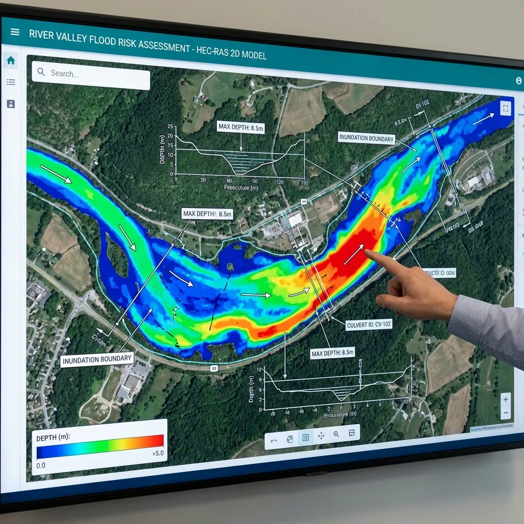
A 2D flood risk analysis studies how a parcel or a building may be affected by flooding with a hydraulic model that computes how water spreads over the terrain in two directions. HEC-RAS analysis is one of the tools commonly used for this: the 2D module of HEC-RAS divides the terrain model into a computational mesh and computes the water depth and velocity in every cell. This article summarises the steps of a HEC-RAS 2D study and what to watch in each. The model type and scope of any project are set by the data, the flow conditions and the competent authority's written request.
When is a 2D analysis needed?
Where the flow is mainly inside the channel and one-directional, a one-dimensional (1D) model based on cross-sections is often sufficient. A 2D model can be more suitable where water spreads laterally over the floodplain, several flow paths form, road embankments or structures steer the water, or the depth and velocity in different parts of a parcel must be known separately. A 2D model is not an automatic requirement for every project; the choice depends on the data, the purpose of the study and the authority's request. For the differences in data, outputs and result checks, see comparing HEC-RAS 1D and 2D.
Data and the terrain model
The quality of a 2D model depends largely on the quality of its terrain model. Terrain data can come from a survey, LiDAR or a digital elevation model, and its source, resolution and date should be recorded. The channel section, bridge and culvert geometry and structures that steer water, such as road embankments, must be represented in the terrain model. The Manning roughness coefficient (n) is assigned according to land cover; for values you can use the Manning roughness table and the Cowan calculator. Old or low-resolution terrain data can change the result noticeably in narrow streams and at road embankments. For details see terrain data for HEC-RAS and data and project files required for flood analysis.
Computational mesh and boundary conditions
The mesh divides the terrain model into cells. Cell size is chosen according to the purpose of the study and the scale of the terrain features: smaller cells can be used in the channel and around structures, larger ones over wide, flat areas. Linear features that block or steer water, such as a road embankment, a levee or a high bank, are built into the mesh with breaklines; otherwise water can pass where it could not in reality. Boundary conditions define the model's inflow and outflow: usually a discharge hydrograph upstream and a water level or normal-depth condition downstream. It should be checked that the boundary conditions are far enough from the area of interest. For how to find the discharges see how flood discharge is calculated, and for the mesh and boundary conditions see the 2D computational mesh and HEC-RAS boundary conditions.
Model set-up, time step and result checks
HEC-RAS 2D can solve the flow with the full momentum equations or with the diffusion wave approximation; which is suitable depends on the character of the flow and the purpose of the study. The time step affects the stability of the computation; the recommendations in the user's manual on the Courant number and time step should be followed. After the run the results are checked: is the volume accounting output acceptable, are there cells that dry out or collect water abnormally, are depths and velocities in the expected range? The model can also be compared roughly with another method, for example a simple section calculation, to test whether the results are reasonable. Even when the results look clean, the uncertainty in the inputs does not disappear.
Turning the outputs into a risk analysis
The model produces outputs such as water depth, velocity, water-surface elevation and, where needed, the product of depth and velocity. The real contribution of a risk analysis is reading these outputs together with the parcel boundary, ground level and building elevations. Different parts of one parcel can see different depths, so the building's entrances, its ground-floor level and the flow paths around it are examined rather than a single cell value. For how to read the maps see reading flood hazard maps and parcel flood risk. For the whole workflow, how a flood risk analysis is done is useful.
Uncertainty, scenarios and reporting
Sensitivity tests with reasonable alternatives for inputs such as roughness, boundary condition, discharge and terrain resolution show how much the result depends on each assumption. Where an observed water level exists, comparing the model with it increases confidence; for the principles and methods see hydraulic model calibration and uncertainty in flood models. The report should present the purpose, data, methods, assumptions, scenarios and results in a traceable way and should also say which questions it does not answer. HEC-RAS analysis and 2D flood risk analysis do not replace an authority's opinion or approval; an authority's opinion is that authority's own assessment.
Common mistakes include not checking the resolution and date of the terrain model, not building linear structures such as road embankments into the mesh, placing boundary conditions too close to the area of interest, presenting a single scenario as a definite result and never comparing the model with an observation or a rough check. If the mesh is too coarse, narrow channels and structures are not represented well enough; if it is too fine, the run time grows without need. The mesh resolution should therefore match the level of detail of the terrain data and the purpose of the study.
An analysis shows the ground and building conditions at one point in time. Later fill on the land, a new road or a change in the channel can alter the result, so the report should state which date's conditions it rests on, and the analysis should be updated when conditions change significantly.
Sources and related articles
Let's define the scope and data of a 2D flood model for your project together.
Request a project quote