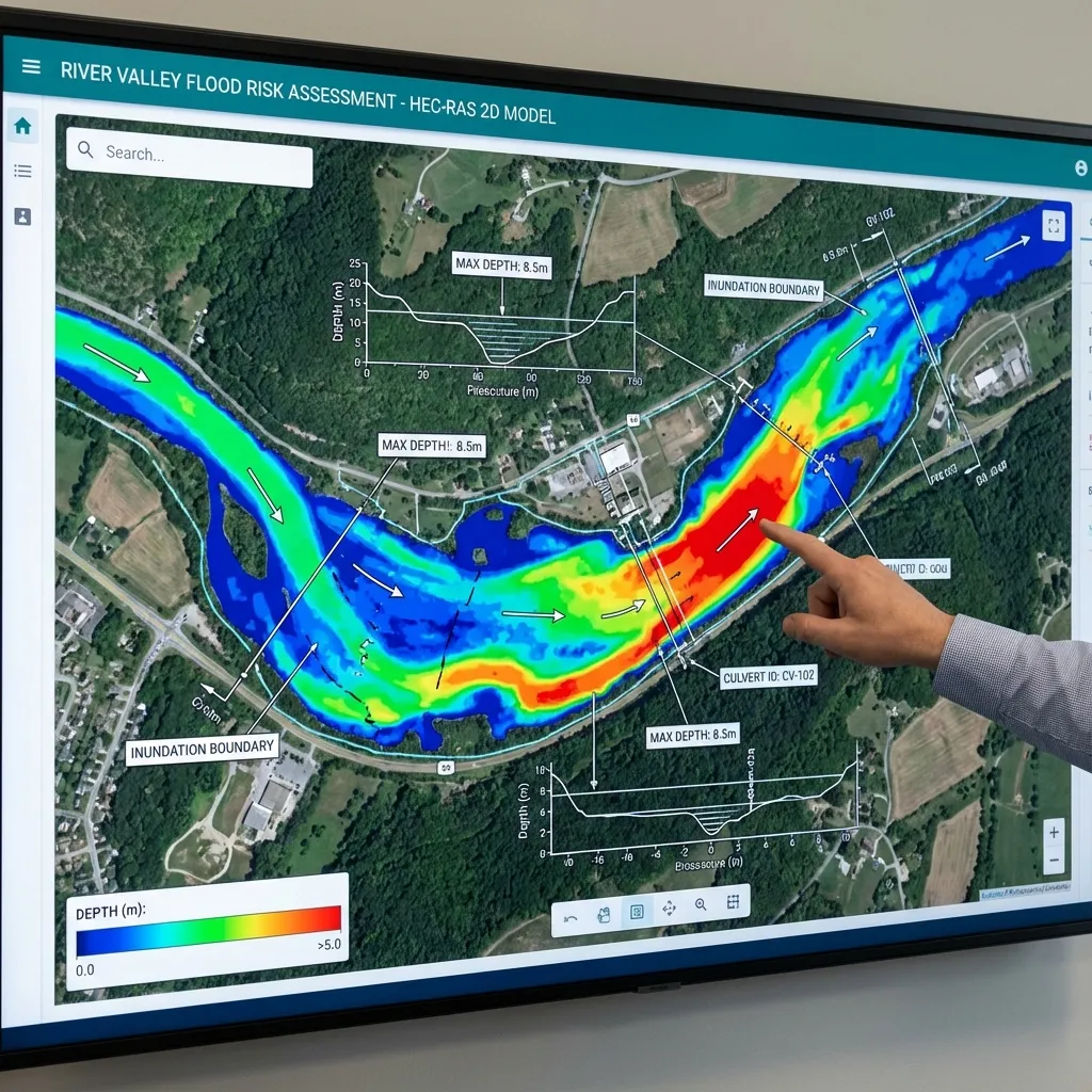
Study scope and duration depend on data suitability as well as area. Outdated terrain, missing bridge dimensions or unclear elevation references can require new surveys after modelling starts. An organised initial package helps define a realistic quotation and study limits. Requirements vary by project; use these groups as a starting checklist and confirm the specific needs.
Location and study boundary
Supply coordinates, current site boundaries, nearby watercourses and relevant roads. Georeferenced CAD or GIS files are more useful than screenshots. State the coordinate system, units and preparation date. The hydraulic domain may extend beyond parcel lines to capture upstream and downstream controls. Describe structure type, existing or proposed use and alternatives in a short project note so data requests respond to a defined engineering question.
Terrain and channel surveys
Assess terrain models, cross-sections, channel bed, bank crests and road embankments together. Vertical accuracy and submerged-bed representation matter as well as horizontal resolution. Record survey date, method, coordinate system and vertical datum. Accompany point clouds or rasters with documentation. Missing beds or bridge openings may need additional surveys. Identify uncovered and interpolated areas from the outset.
Hydrological and observational information
Share rainfall series, flow observations, previous discharge calculations and historical-flood information. A result-only discharge table may not permit reassessment: station identity, location, record period, gaps and methods matter. Dated and located photos or high-water marks can support checks, with their measurement uncertainty. A photograph without timing or elevation is not sufficient calibration data. Preserve source attribution and data-use rights.
Structures and proposed project geometry
Bridge openings, piers, soffits, culvert dimensions, invert levels and walls are important controls. Supply current architectural or infrastructure drawings with proposed fill and excavation. A structure shown on a plan may still need measured sections or inspection. Separate revision dates and versions to prevent modelling the wrong geometry. Distinguish features physically present from design alternatives and keep existing and proposed files separate.
Requirements, deliverables and missing data
Include written authority requirements or technical scope where available and list expected reports, maps, models and drawings. Share technical requirements without unnecessary personal or sensitive information. After review, classify data as available, usable, needing updates or missing. Making gaps visible at quotation stage improves survey planning and scheduling. The objective is reliable, sufficient input for the engineering question, rather than maximising the number of files. Use clear location, date and version filenames and preserve original surveys.
Translating results into project decisions
A project owner should receive more than a coloured map. The report should bring together the data inventory, survey date, horizontal and vertical reference systems, method used to obtain discharges, scenarios examined and limits of the model domain. Legends, scales, scenario names and elevation references make maps easier to compare with architectural or infrastructure drawings. Calculations should explain the reasoning behind a decision and identify the assumptions whose revision would require the results to be reconsidered.
At quotation stage, share the study boundary, structure type, available surveys and expected deliverable files. These details help define the scope and additional data requirements. Discharges, elevations or design approaches taken from another project should not be transferred directly to this site. The competent authority's project-specific requirements are checked separately. A flood assessment does not guarantee that no future event will occur; it provides an engineering basis for understanding risk and comparing mitigation options under the selected data and scenarios.
Sources and related articles
- USACE — HEC-RAS User's Manual: geometry and flow data
- NRCS — Hydrology and hydraulics technical references
- Terrain for HEC-RAS: Resolution, Elevations and Survey Quality
- Delineating Catchments from Digital Terrain Models
ArchSu — Flood-study data checklist
Mark the files available for the first discussion. Missing data is assessed when defining the study scope.
- □ Province/district, location and parcel or project boundary; map with an identified coordinate system.
- □ Report purpose: development plan, building permit or another project need.
- □ Any current authority request, planning notes and previous opinions.
- □ Terrain survey/DEM, survey date, resolution and vertical datum.
- □ River cross-sections and bridge, culvert and other structure dimensions and levels.
- □ Existing and proposed building, ground and entrance levels; project drawings.
- □ Any rainfall/flow records, previous hydrological study and discharge/hydrograph files.
- □ Required report, maps, drawings and model files; desired delivery date.
Agree a file-sharing method during the first discussion via archsu@archsu.com. This is a preparation checklist, not an application document or a universal list of mandatory files.
Let's discuss your project's data requirements and reporting scope.
Request a project quote