Flood extent maps
Mapping of modelled flood areas for the return periods selected for the project.
We prepare flood analyses and technical reports for land and building-permit projects across Turkey. Share your location, available surveys and any written DSİ or municipal request so we can define the report, maps and model outputs.
When a flood assessment is requested for a parcel or building project, a technical report examines the study area in relation to the river and floodplain. Rainfall and catchment data, flood discharges, terrain and building elevations and the necessary hydraulic scenarios are considered together. The written authority request and project conditions determine the scope.
Technical report and authority opinion: ArchSu provides analysis and technical report preparation. An opinion issued by DSİ or a municipality is the authority’s own assessment. Application tracking, acting on behalf of an authority and a commitment to approval are outside this service. Requirements at development-plan and building-permit stages are reviewed separately.
Final deliverables, input data and project requirements are agreed during the quotation stage.
Mapping of modelled flood areas for the return periods selected for the project.
Assessment of flood hazard using modelled water depth and flow velocity outputs.
A technical report documenting data sources, hydrological calculations, model assumptions, scenarios, elevation assessments and findings. Maps and file deliverables are defined in the quotation.
If some data is not ready, share what you have so we can discuss how the gaps affect the study scope.
Share the location, project purpose, available data and required report. Scope and schedule are determined after the data review.
A quotation follows a review of location and available data. Two parcels of the same size may require different data and hydraulic study boundaries.
The adequacy of terrain surveys, cross-sections and bridge/culvert information affects additional data needs. Required surveys and responsibility for supplying them are specified in the quote.
The catchment, river reach, number of structures, need for 1D/2D modelling and scenarios determine the work involved. Scope is not set solely by parcel area.
The report, drawings and any required model files are specified together. The schedule depends on usable data being supplied and the agreed scope; authority review has its own timeline.
Model choice depends on flow conditions, terrain, structure geometry, available observations and study purpose. A 2D model or a particular return period is not an automatic requirement for every project.
1D approach: For studies representing flow along a channel network, cross-sections, bridge/culvert geometry and discharge data form the basis of the model setup.
2D approach: Where lateral flow across a floodplain matters, the terrain model, computational mesh, boundary conditions and time step are considered together.
Depending on the agreed scenarios, deliverables may include water-level, depth, velocity and extent maps, plus a technical report explaining model assumptions and data limitations. File formats and scope are set in the quotation.
Discuss HEC-RAS modelling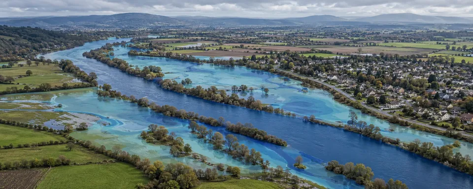
Compare 1D and 2D flood analysis by data, outputs and result checks
Flow assessment along channel and structure cross-sections.
Scenario-based review of depth and velocity over the terrain.
Considered where a project needs to represent interaction between channel flow and floodplain flow.
Understand your project needs and the data you already have.
Understand the difference between a technical report and an authority opinion, and the study steps.
Read the guidePrepare the location, survey and authority request using a printable checklist.
Read the guideExplore how terrain levels, building levels and model results are interpreted together.
Read the guideThe schedule is determined for each project during quotation, based on the study area, available data and required analysis scope.
The model is selected after reviewing the topography, flow conditions, project purpose and technical requirements of the reviewing authority. The analysis scope is determined for each project.
Pricing is determined by factors such as basin area size, river network complexity, availability of topographic data, and specific municipal or DSİ requirements. Contact us for a custom quote.