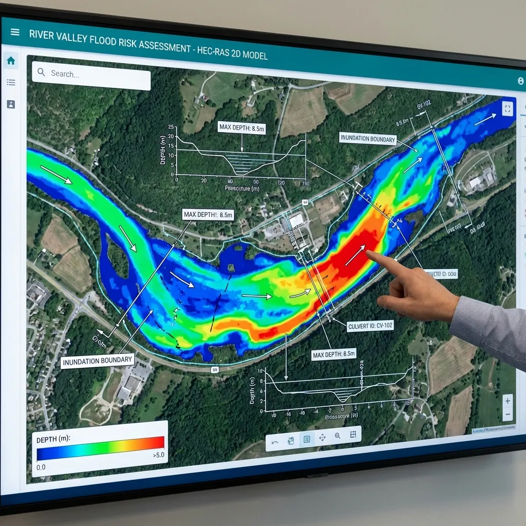
News about urban flooding often blames a single cause: “the rainfall was extreme”, “the stream channel narrowed” or “the infrastructure was inadequate”. In engineering terms each of these points to a separate mechanism, and several can act together in one event. This article does not assess any event; it explains the general hydraulic causes of urban flooding and the data used to examine them.
Three different sources: stream, network and surface
In a built-up area, water can come from a stream or river, from the stormwater network, or from surface runoff collecting around buildings and roads. If a stream overflows, channel capacity and structures matter; if the network is exceeded, pipes, inlets and outlet conditions matter; if surface runoff pools, topography and depressions matter. All three can occur in the same rainfall, so the study scope should define which sources are examined. Different neighbourhoods of the same city can be affected by different mechanisms: a hillside street may meet fast surface runoff, while a basement near a stream meets a rising stream level. Urban flooding is therefore examined not with one calculation but with a separate one for each mechanism and, where needed, their combination.
Impervious surfaces and rainfall-runoff conversion
Roofs, roads and car parks reduce infiltration, increase runoff volume and can shorten the time water takes to reach the outlet. The Rational Method represents this through the runoff coefficient C and time of concentration; its suitability depends on the catchment and study purpose. See time of concentration and the Rational Method. FHWA's Highway Hydrology (HDS-2) covers the scope and limits of hydrological methods. As development grows, the same rainfall can produce a larger peak, so earlier calculations should be reviewed against current land use. Permeable paving, green areas and storage volumes can reduce this effect, but their effectiveness depends on soil, slope and rainfall duration and should be demonstrated for the project.
Culvert and bridge capacity
Where a stream passes through a culvert or bridge in a city, the structure can constrain the flow. For culverts, inlet-control or outlet-control conditions determine how far the upstream water level rises, as described in FHWA's Hydraulic Design of Highway Culverts (HDS-5). Even if computed capacity is adequate, branches, litter or sediment that partly block the opening reduce real capacity. This links to the clearance and debris allowances in bridge and culvert hydraulics and to normal and critical depth. If the upstream water level reaches the road or building elevation, flooding can occur before the structure's capacity is fully used, so upstream levels and obstructions around the structure are assessed together.
Backwater and outlet conditions
Stormwater lines usually discharge to a stream or the sea. When the receiving water level is high, outlets are partly submerged and the network's discharge capacity falls; this is a backwater effect. A hydraulic model represents it with boundary conditions, and a poorly chosen downstream condition can change results noticeably; see HEC-RAS boundary conditions.
Channel change, sediment and maintenance
Fill, narrowed sections, accumulated sediment and vegetation can change conveyance over time. Among the purposes of the Flood and Sediment Control Regulation is defining the permits and approvals required for works in stream beds and adjoining land, so the effect of a channel intervention should be demonstrated hydraulically. FHWA's HEC-20 on stream stability covers how bed and bank change affects structures; see also sediment and bed equilibrium. Maintenance records such as bed and screen clearing help show whether the model's assumptions represent the real condition.
No single fix: separate the mechanism first
Storage, channel rehabilitation, larger culverts, network expansion or rerouting of surface flow may each be considered; which one fits depends on the source of the flooding. Comparing alternatives without an existing-condition model is unreliable. See river rehabilitation cross-section selection. Each measure's benefit should be reported together with its rainfall, land-use and boundary-condition assumptions.
Sources and related articles
Let's clarify the scope of stream, culvert and drainage-related flooding together.
Request a project quote