
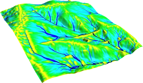
Hydrological modelling is the mathematical representation of how rainfall on a catchment becomes surface runoff, routing and discharge at the outlet. A model is a simplified description of the real catchment: it expresses processes such as rainfall, losses and the movement of flow over the catchment and along the channel through parameters. Its purpose is to estimate discharge and hydrographs for conditions that cannot be measured or have not yet happened (for example a 100-year storm).
The basic components of a model
Rainfall-runoff models usually consist of a few components: the rainfall input; a loss component for the part of the rainfall that does not become surface runoff (for example SCS-CN); a transformation component that distributes the surface runoff in time at the outlet (for example a unit hydrograph); baseflow where relevant; and routing, which represents the movement of flow along the channel. Each component carries its own assumption and parameters. The loss method determines volume and the transformation method determines timing; the two must not be confused. For example, the SCS-CN method gives only runoff depth, not the peak discharge.
Types of model
Event-based and continuous models: Event-based models simulate a single storm, continuous models a long period including dry and wet spells. Design floods are usually computed with event-based models.
Lumped and distributed models: Lumped models treat the catchment as one unit, distributed models divide it into grid cells or subcatchments. Distributed models need more data.
Empirical, conceptual and physically based models: Empirical methods (such as the Rational Method) rest on simple relationships and physically based models on process equations; conceptual models lie between the two.
What data are needed?
The catchment boundary and subcatchments, land use and soil information, rainfall data (a design storm or observations) and, where needed, flow observations and channel cross-sections are the basic inputs. The source, period and treatment of missing data for rainfall and flow records should be documented. Software such as HEC-HMS provides these components as ready-made methods; using the software does not show that the method suits the catchment.
Calibration and validation
Where observed rainfall and flow exist, model parameters are adjusted to one event (calibration) and tested against another (validation). Without observations, parameters are chosen from literature values and the uncertainty is shown with sensitivity tests. The same principles for a hydraulic model are described in hydraulic model calibration and validation.
When is a model needed?
If only the peak discharge is needed and the catchment is small and simple, the Rational Method may be sufficient (see the calculator). A rainfall-runoff model is needed when runoff volume, hydrograph timing, storage effects or several subcatchments are involved. However detailed a model result looks, it does not remove uncertainty; the report should show which inputs the result depends on (uncertainty in flood models).
Limits of a model
A model is only as reliable as the observation data and the parameter choices.
A calibrated model may not give equally reliable results for events far outside the calibration conditions.
A hydrological model produces discharge; computing how the water rises in the channel and floodplain needs a separate hydraulic model.
When reporting a model result, these questions should be answered: For what purpose and for which event or scenario was the model built? Which components (loss, transformation, baseflow, routing) were represented by which method and why? Where did the parameters come from: calibration or the literature? Which inputs is the result most sensitive to? The answers make the model a traceable engineering study rather than just a software output.
When deciding whether a simple method is enough, the size and complexity of the catchment, what the output will be used for and how reliable the data are are considered together. A very detailed model built on insufficient data can give a misleading impression of certainty, so the level of detail of the model should match the level of detail of the data. Where needed, the results of simple and detailed methods are compared to show the reasonable range of the result.
Hydrological modelling alone does not produce a flood map. The discharge from the model is passed to the hydraulic model as a hydrograph, and the map is created there from the depth and velocity outputs. The assumptions of these two stages should be stated separately. If land use in the catchment changes (for example new development), the parameters change too, so present and future conditions can be computed as separate scenarios and the report states which condition it rests on.
Choosing a model is not choosing software; it is choosing which method represents which process. The same software can contain very different methods, each requiring different assumptions and data. The report is therefore expected to state the methods, parameters and data sources used instead of just the name of the software, so that the reader can tell which method and which assumption the result rests on.
Sources and related articles
Let's decide on a suitable hydrological modelling approach for your catchment together.
Request a project quote